
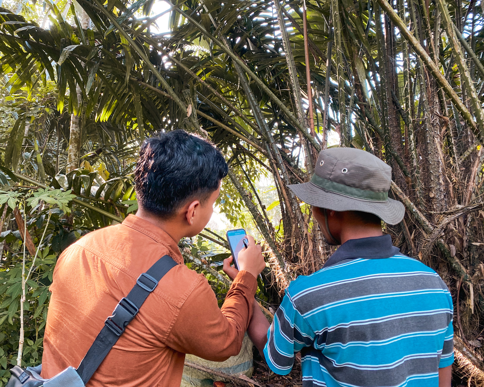
Farmer Mapping: Best Practices in the Field
Mapping smallholder plots is less about technology than trust, and here is the two-phase field model that takes a commodity buyer from zero polygon coverage to a EUDR-ready dataset in weeks.
A GPS-verified polygon may be the closest thing many smallholders have to a formal record of their plot boundaries. Farmers who participated in Agridence mapping projects, from rubber smallholders in Sumatra to cocoa farmers in Nigeria, have noted that the data helps them understand the true size of their plots: useful for yield estimates, group negotiations, and land tenure documentation.
When farmers understand that traceable produce opens the door to better prices and verified market access, participation becomes self-sustaining. Polygons collected today become a reusable asset for every future requirement and benefits both ends of the supply chain.
How Agridence Runs a Mapping Project
Agridence deploys a structured two-phase field model built on years of on-the-ground experience mapping smallholder farmers across Indonesia, (rubber), Nigeria (cocoa), and Côte d'Ivoire (cashew).
PHASE 1 – Socialisation
Agridence partners with a local field team, equipping them with comprehensive training on our services, processes, and tools to ensure seamless alignment with our standards. Before any mapping begins, Agridence secures the village chief's approval. This is non-negotiable. Arriving without the village head's knowledge risks the entire community's participation – a briefing can be cancelled on the spot, and trust is difficult to rebuild. Agridence coordinates a formal introduction, supported by a letter from the client's factory, so the field team arrives with institutional backing.
With the village chief aligned, a community socialisation session is held. Client teams, Agridence, and local field partner visit selected villages together. Farmers are briefed on the project purpose, how their data will and will not be used, and what they stand to gain. Enumerators (people employed to collect data directly from individuals or households, usually through surveys, interviews, or on-the-ground observations) give a live demonstration of how AgriTrace works. Sessions are kept to groups of five or fewer, with farmers separated by device type: smartphone and feature phone users need different walkthroughs.
This phase surfaces supply chain realities, identifies key intermediaries such as agents and farmer group leaders, and builds the community trust that drives Phase 2 conversion rates.
PHASE 2 – EXECUTE AT SCALE
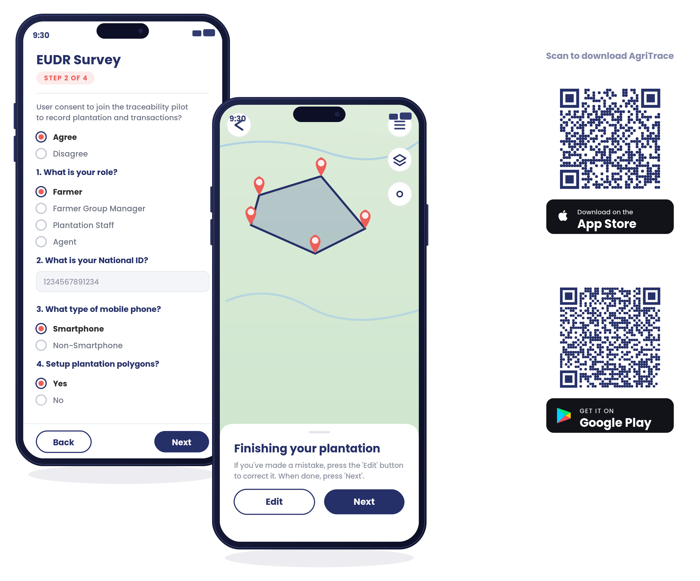
A trained field team consisting of enumerators and a supervisor carries out polygon mapping and survey interviews independently. Surveys can be tailored to each project's compliance requirements: an EUDR-aligned legality questionnaire for the respective crop and region in a single farm visit. Enumerators begin at 2–3 polygons per day; within the first week, that rate typically doubles as proficiency with the tools and local terrain increases.
Every project closes with a detailed report: polygon counts, total area, deforestation risk findings, supply chain structure, and recommended next steps.
THE TECHNOLOGY
Agridence uses a mobile app AgriTrace for polygon capture, farmer questionnaires, and transaction recording. The AgriTrace app works offline, syncing data when a connection is available.
What the Numbers Look Like
Across our mapping pilots in the last 2 years, Agridence achieved:
132k polygons mapped
390k ha plantation area covered
88%+ average farmer conversion
~3 weeks per deployment
In one pilot, strong support on the factory-floor from the client's local processing partner drove a 93% farmer conversion rate and triggered organic referral, with farmers actively introducing field teams to their neighbours once they understood the benefit.
The factory's plans on providing specific storage for EUDR traceable rubber led to farmer enthusiasm as they perceived it as an opportunity to improve their standard of living. The same model has been deployed at significantly larger scale for cocoa in Nigeria and cashew in Côte d'Ivoire.
In Côte d'Ivoire, the cashew programme combines EUDR polygon mapping with preliminary organic assessment consisting of several hundred plots captured across cooperative networks in the first phase. Quality assurance after fieldwork flagged more than fifty overlapping plot pairs for correction. This level of rigour is essential when the same dataset must satisfy both deforestation auditors and organic certifiers.
Five Practices That Determine Success
1. Engage village authorities before arrival. A factory or trader-issued letter of introduction to the village head prevents the friction that derails community briefings.
2. Group farmers by device type. Separating smartphone from feature-phone users in demo sessions means nobody gets left behind and both types can transact.
3. Let the supervisor handle onboarding of new field agents. Enumerators who focus only on polygon capture and farmer interviews perform better than those who are pulled across multiple responsibilities.
4. Address data privacy head-on. Farmers worried about tax surveillance or data sharing need a clear, written explanation of what is and is not collected. Village head endorsement helps.
5. Make the buyer a partner, not a bystander. When client teams join field visits, whether that's a rubber factory in Sumatra or a cocoa trader's representative in Nigeria, their presence lends a credibility that converts hesitant farmers faster than any amount of explanation from enumerators.
Traceability platforms don't onboard farmers, people do. The technology handles polygons, transactions and evidence, but these five practices handle everything else. Get both right and a field programme scales.
Ready to Map Your Supply Base?
Agridence has the field infrastructure, technology, and methodology to take a commodity buyer from zero polygon coverage to a EUDR-ready dataset within weeks. The process is proven, scalable, and designed to create lasting value for every party in the supply chain.
Speak to the Agridence team to scope your first mapping project.